
Weather in Ouranoupoli and Mount Athos
 Ouranoupoli Weather, specially in the beginning of winter in January prevailing high pressure combinations at Balkans with low at west initially and after at the South Sea. Result is the weather in Ouranoupolis and Mount Athos to be rainy with more snow on Mount Athos, depending on the temperature. Generally prevailing northern winds. If the winds is from NW they affect Ouranoupolis and the western part of the peninsula of Athos enough. The ripple on the west side is related to how the NW is the direction of the winds and at the Ouranoupoli area is relatively small, but as descends south grows enough and can create problems in maritime transport in the region, while in the east parts there is not problems.
As goes the winter and early spring (February – March) the barometric combinations are replaced by cold air masses invasions from the Balkans thus more prevalent strong NE winds, rain and snow is much less and more affecting the eastern windward parts of the Athos peninsula and almost no Ouranoupoli. The ripple in the eastern and southern part of the peninsula of Athos is too large and there may be problems in marine transportation from the eastern side of the mountain, while the west side, in the area of Ouranoupolis, the ripple is too small and does not affect sea transportation.
In spring (March – April – May) Ouranoupoli Weather, the cold invasions gradually stop and when there are low barometric pressures at Aegean sea, southerly winds affecting almost the entire seafront of the peninsula. The ripple, depending on the intensity of the winds, is very large and directly affect the entire western side of the peninsula and the sea of Ouranoupoli. Impressive and beautiful phenomenon for photos but prohibitive for sea transport. On the east side as we go further north the waves diminishes and ends as swell depending on the orientation around the waterfront. The rains are very less and gradually begin to appear the first thermal clouds over the mountain.
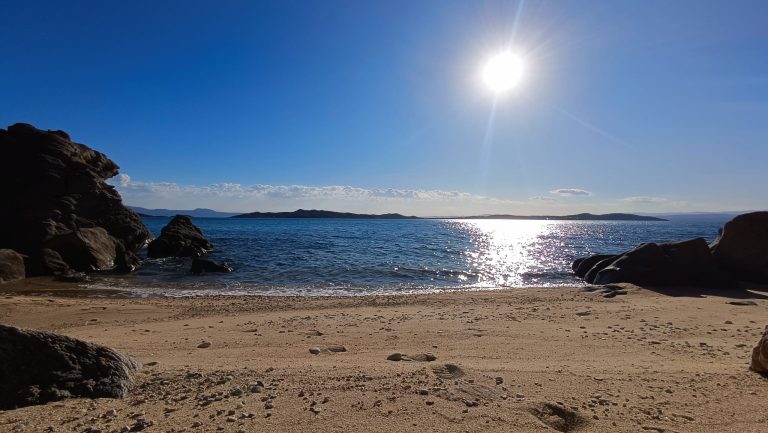
As spring progresses (in May), the weather is generally very good and at the whole waterfront mainly blows in the afternoon sea breeze. The sea breeze is a local wind and when stars to blow is perpendicular to the coast and then turn to the movement of the sun, showing a maximum in the afternoon and weakens with the sunset. The winds at the Spring is generally weak, at the coasts blowing breezes, but over land, especially when the atmosphere is unstable, prevailing local growths or storms. Generally, the ripple spring does not cause problems in maritime transport both the eastern and the western part of the peninsula.
Ouranoupoli Weather in summer (June – July), the prevalence of high barometric systems does not create winds but continued due to atmospheric instability (especially in the beginning of the period) the emergence afternoon local developments or storms of short duration. The maximum temperature on the coast is very much influenced by the sea breeze which is stronger, so that, it is less the maximum temperature and the feeling of the heat. Gradually begin to increase the meltemi (August) ,local wind in Aegean, affecting the eastern Athos peninsula, Ouranoupolis less, while at the morning blows the apogee aura. In the eastern areas of t he peninsula the wind quite particularly strengthened in the afternoon along with the sea breeze, while the area of Ouranoupoli and the western part of Athos affected much less. As for the waving of the eastern regions of Athos there is strong ripple increases as we go further south and affected some of the south western parts of the peninsula due to the swell that turns inside. In the western part of Athos except the south and in the Ouranoupoli area while blowing the ripple is relatively small and does not create problems.
In late summer and early autumn (August – September) the meltemi winds weaken, local breezes blow fainter, but when there is instability in the atmosphere created local thunderstorms, mostly over the sea and the coast, continuing and the early evening hours. The ripple in the sea is low (except in the areas of storms) there is no prevent at maritime transport, and the temperature was perfect for swimming.
Gradually in the autumn (September – October) the meltemi winds and the local breezes fade completely, the winds are weak, the temperature is still good, there is no ripple, ideal conditions for swimming and generally the weather is very good until to come down from the north the first cold air masses and start blowing the former northerly winds. The first rains, generally from combinations of barometric systems (November), is the sign that we approach the winter.